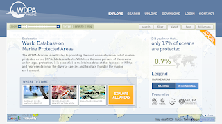
 The UNEP-World Conservation Monitoring Centre (UNEP-WCMC) today unveiled The World Database on Marine Protected Areas - a site designed to provide the most comprehensive set of Marine Protected Areas (MPAs) available.
"With less than one percent of the oceans under legal protection, i
t is essential to maintain a dataset that focuses on MPAs and representation of the diverse species and habitats found in the marine environment." is read on the website.
Vizzuality has developed the User Interface and general design of the website, including the logo. Working together with UNEP-WCMC, and specially Craig Mills, we have developed innovative solutions to display this huge amount of data in a hopefully engaging website to invite people explore our oceans.
But enough of "official words", here at biodivertido we would like to explain what are the technologies behind it and how things work under the hood.
Technologies:
The website is a mix between HTML and Flash. The Flash application in the front has been developed using the Flex framework plus some Flash little things. On the ser
ver s
ide there is ASP.NET and WebORB to do AMF remoting.
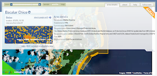
GIS:
The GIS engine behind the scenes is ESRI ArcGIS Server. WCMC pr
epared the different tiles
and caches for all layers. There is some places where we have used the new ArGIS Server REST API.
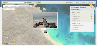
On the client side the whole project is very much based on the great Google Maps API for Flash. We want to thank Pamela Fox from Google for her great support of the community. There is several techniques that we have introduced while working on this project like:
- Tile Mouse Over: To change the cursor when hovering over features on tiles.
- WMS overlays: Dynamically changing the Tile Overlays based on zoom levels for cached and not cached tiles.
- Panoramio and Wikipedia markers without proxies.
- Encoded Polilynes for multipolygons with inner rings.
Database:
WCMC is using Microsoft SQL Server 2008 Spatial Database and we worked with them to generated Google Encoded Polylines out of the database.
There are also some things coming from the ESRI spatial database and some stats where dones using it, but I think the general idea is to mo
ve everything to SQL Server.
Deployment:
The whole website is being served from an Amazon EC2 instance. The idea is also to make use of the Amazon Cloud Front CDN to distribute tiles and other static files, but for the moment everything is in EC2.
We will probably post more specific details on different parts of this project in the next weeks, but we wanted to give you a broad overview of how the project works and the different technologies being used.
One more thing...
One great thing of working with UNEP-WCMC is that all the source code that we have developed is Open Source! We are still working on specific details on what license the source will get, but for those curious, starting from today you can checkout all source code from Vizzuality SVN repository. Please let us know if you find it interesting!
We are still under Beta phase of the project, so it might be that you find some bugs, please report them!.
Thanks again to UNEP-WCMC to let us work on this great project and look forward to make it better!


1 comment:
Congratulations! Well done!
Post a Comment